|
|
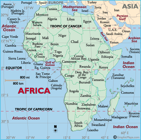
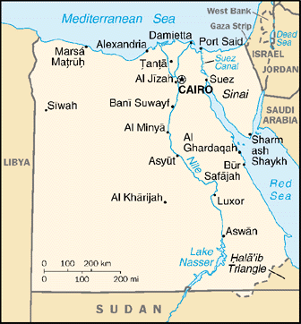
Egypt occupies a strategic location on the
African continent. It extends from the
Mediterranean Sea in the north to Sudan in the
south, and from the Red Sea in the east to
Libyan Arab Jamahiriya in the west.
Even though the total surface area is about
one million square kilometers, less than 5% of
the land is inhabited. |
|
 |
For a larger view, click on the image.
|
|
|
|
|
Egypt is divided geographically into three
regions, which are further divided into 26
administrative governorates.
These regions are:
|

|
The Northern Region: Lower Egypt, the Nile
Delta
|
|
The Southern Region: Upper Egypt, the Nile
Valley
|
|
The Frontier Areas
|
According to the 1996 census, nearly 43% of
the total urban population lived in Cairo (the
Capital) and Alexandria. Cairo the largest city
in Africa, has a population of 6.790
million.
The total population in 1996 was 59,272,382
million, including an estimated 2.2 million
residing abroad. The population is growing at
the rate of one million every eight months,
which would give Egypt a population of more than
68 million by the turn of the
century.According to the latest estimation conducted
by EDHR, Egypt’s population reached nearly
65335.6 hundreds in 2001.(Egypt
Human Development Report 2003).
|
 | | |
| | |