| A first phase of the project, dubbed
NKOS I, ran for five years from 2001 to 2004. It focused on the northern
portions of ancient caravan routes and on the late Roman installations
that dot the area. Because of the amount and variety of archaeological
material that was found in the western area, NKOS started a second phase
of research, which concentrated on the exploration of the ancient
caravan routes leading west towards Dakhla, NKOS II, This is scheduled
to last least three years (2005-2007). The
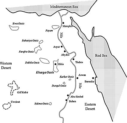
northern area of Kharga contains archaeological sites dating from the
prehistoric period to the nineteenth century AD. The most unexpected and
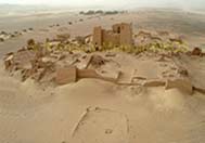
startling of the remains in Kharga are the forts of the Roman period,
mentioned in passing by early travellers and geologists, and never
properly investigated. In addition to the forts, the Prehistoric sites
are numerous and significant, but the millennia that separate the
prehistoric sites from the Roman forts are scarcely documented. |
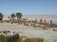
| As the area of the survey is enormous,
and the state of preservation of the remains uneven, a variety of
techniques are used by NKOS to locate and document the sites. The areas
around the visible archaeological remains are explored on foot, whilst
four-wheel vehicles are employed for the large-scale exploration of the
surroundings. The position of isolated features (such as cairns marking
the ancient routes) are recorded by means of a Global Positioning
Systems (GPS). A theodolite survey is carried out for areas with a
particular concentration of archaeological remains, and architectural
features such as buildings or tombs are recorded in detail to a smaller
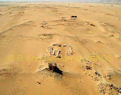
scale. Aerial photography is not only used to document the overall
appearance of the sites, but also to identify and record ancient
irrigation systems and areas of cultivation. The research is completed
with the collection and analysis of ceramics, small objects,
archaeobotanic and archaeozoological samples.
NKOS is not only producing a map of the area, but is
also trying to understand the relationship between the different sites
through the millennia, as well as the ancient environment that shaped
the oasis's history. Beside its agricultural wealth, in antiquity the
oasis was most significant also for its strategic location in the
Western Desert. Kharga acted as a major crossroad linking Egypt, Sudan,
Libya, Central and Western Africa. As early as the Old Kingdom, the Darb
el-Arbain - the Road of the Forty Days between Middle Egypt and the
Sudan - gained a certain importance as an alternative route to
travellers and traders who wished or were forced to avoid the Nile
Valley. This route was also important for strategic reasons - as the
Egyptians learned in the Second Intermediate Period when the Hyksos-Nubian
alliance tried to bypass the Nile Valley via the oases.
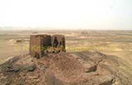
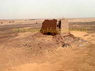
When the Romans conquered Egypt, Upper Egypt became
part of the southern frontier of their empire. After a serious crisis
during the third century when the empire suffered several devastating
attacks from barbarians and nomads, at the beginning of the fourth
century AD, the emperor Diocletian launched a program of reinforcement
of the fortifications along the frontiers of the whole empire. Kharga
was clearly identified as an important way of penetration into the Roman
territory, and a series of military installations were built at the
junction between the north-south Darb el-Arbain and the east-west routes
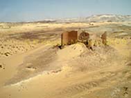
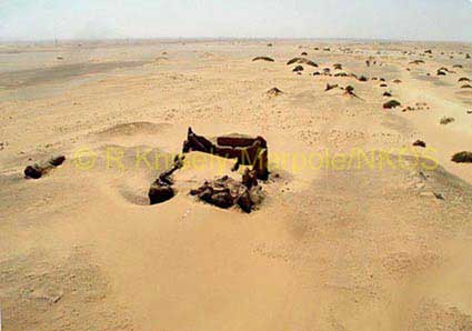
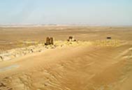
leading to Dakhla and to the Valley. The remains of these fortifications
are the most visible and best preserved antiquities of the Kharga Oasis.
It is possible that at least some of these forts are located on the
sites of their pharaonic predecessors, but only excavation can determine
this. NKOS has also located settlements and sacred areas that
accompanied these military installations.
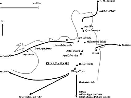
The main archaeological sites that are being
investigated by NKOS are (from north to south): Ain Gib, Qasr el-Sumayra,
Ain el-Lebekha, Muhammed Tuleib, Ain el-Tarakwa, Ain el-Dabashiya and
then going westward Umm el-Dabadib and Ain Amur. |